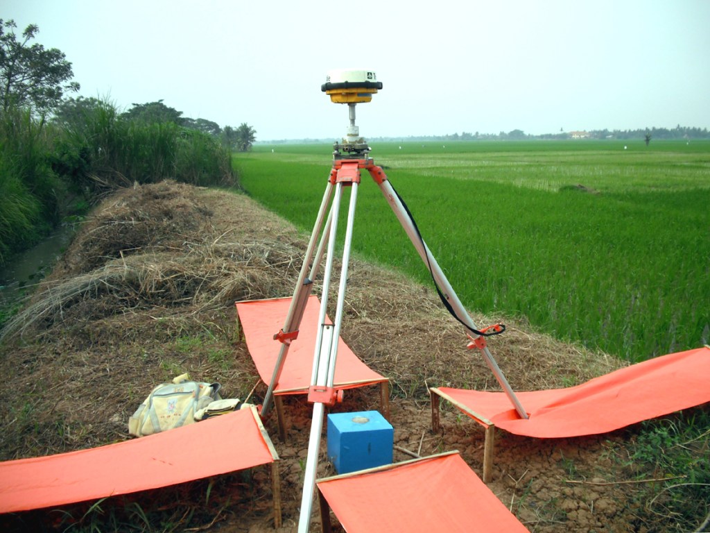
Survey and Mapping
Land survey : Establishing land plot boundaries, measuring distances and elevations, and creating survey plots for development.
Mapping : Creating various types of maps, including thematic maps (e.g., land use maps) and general maps.
Remote Sensing : Using aerial imagery and satellite imagery to collect and analyze data for mapping and surveying.
Data Acquisitions
Data Collection : Acquiring data from tools, sensors, instruments, or other sources, including human sources.
Data Processing : Converting data between formats, sorting data based on requested parameters, provide a presentable dataset, and other type of processing needed.
Data Analysis : Analyzing collected data to identify trends, patterns, or anomalies, which could be use as support for decision making processes.
Data Storage : Storing data in a database or other format for later use or retrieval.
Data Visualization : Presenting data in designated format and media to facilitate understanding and easy analysis.
Geographic Information System (GIS)
Managing and analyzing spatial data, to be use for creating and managing spatial data and other related data in a designated database.
Research & Study
Our services ranging from providing access to resources and expertise to offering specialized support in specific areas like sampling, data analysis, and dissemination of findings.
- Research Support : This includes providing access to government, private, university libraries, databases, and research tools, as well as offering guidance on research methodology and data analysis.
- Study Support : This service includes tailor made assistance with all phases of a research project, from initial planning and design to data collection, analysis, and publication.
- Sampling Services : Develop and implement sample designs for studies, ensuring accurate and representative data collection, and providing enumerators, surveyors, and interviewers for the implementation of the sampling activities.
- Data Analysis : Analyzing collected data to identify trends, patterns, or anomalies with statistical analysis, data cleaning, and interpretation of findings
- Research and Development (R&D) : Provide research design and conduct research to cater client’s objectives.
Consultancy & Advisory
Our experts provide our clients with outstanding technical expertise that enables the successful implementation of complex projects in Indonesia. Our expertise spans across multiple topics including survey and mapping, data acquisitions, spatial database development, research and development, waste management, and cicular economy, to name just a few.